Bamsaru Khal Trek
TREK DIFFICULTY
Difficult
TREK DURATION
9 Days
HIGHEST ALTITUDE
15091 Feet
GROUP SIZE
12
TREK DISTANCE
75 km
BASECAMP
Uttarakhand
BEST TIME
May to June and September to October
PICKUP POINT
Dehradun (Prince Chowk)
Bamsaru Khal Trek
The Bamsaru Khal trek is a remarkable adventure that takes you through the awe-inspiring beauty of the Garhwal Himalayas. Situated in Uttarkashi district of Uttarakhand, at a towering altitude of 4600 meters above sea level, this trek promises breathtaking views and a profound connection with nature. Spanning over 6 to 7 days, the Bamsaru Khal trek is well-suited for adventurers seeking moderate challenges.
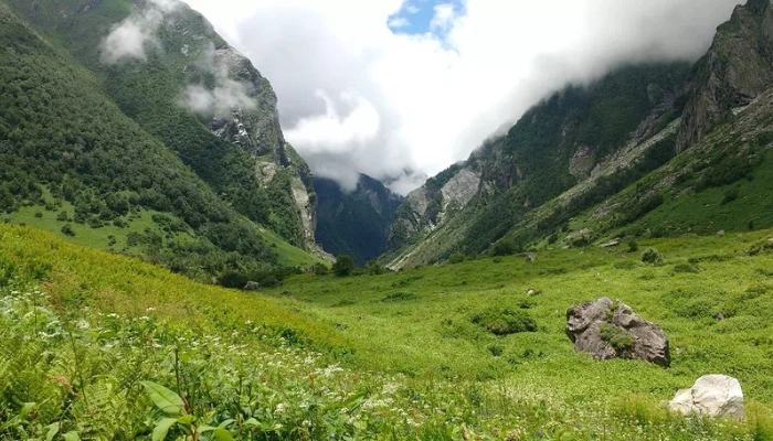
One of the major attractions of this trek is the opportunity to witness the Gangotri group of peaks in all their majestic glory. Bandarpoonch and Kala Nag peaks stand tall, glistening in the sunlight, offering a sight that is nothing short of spectacular. The trail leads you through picturesque meadows, alongside refreshing streams and to peaceful camping spots surrounded by nature's tranquility. The Himalayan wildlife and vegetation keep you engaged throughout the way.
The best time to trek to Bamsaru Khal is May-June and September-October, when weather conditions are most stable, the meadows are in full bloom and views of Himalayan peaks are clearly visible.
History of Bamsaru Khal Trek
The name Bamsaru derives from 'Bam Sarowar' which means lake on the left side. It is located slightly off-route near the khal (pass) and there are few lakes nearby; this might be the region that the pass has received this name. It connects two sacred rivers Bhagirathi (Ganga) and Yamuna. Locals believe that the nearby region of the pass was the place where Ganga and Yamuna once met before separating to flow through different valleys. Thus the Khal is seen as a symbolic confluence of these rivers' energies. Being a revered and spiritually significant place, many yogis and hermits have meditated here.
During the medieval time, the route around the Bamsaru Khal was part of the trans-Himalayan trade corridor which was mainly used by local communities. Locals from the Rawain region and Har ki Dun Valley Trek used these trails for trade like salt, wool and grain between Yamuna and Bhagirathi valleys. These routes had great strategic and economic importance. The Rajput rulers and few tribal clans possessed control over these routes.
In the 19th and early 20th centuries, explorers and British surveyors started mapping the Himalayas. Bamsaru Khal was also mapped and noted in records for its high-altitude pass connecting the Harsil-Gangotri side to the Yamunotri region. Even after independence, the Bamsaru Khal region holds high strategic significance due to its proximity to the Indo-Tibetan border.
Highlights of the Bamsaru Khal Trek
- A Hidden Gem:
Bamsaru Khal is a high-altitude pass which reaches an elevation of around 4,600 m. Due to its high-altitude and less-known status, trekkers don't come here often which has helped it remain untouched and pristine. It's a hidden gem that most trekkers are unaware of but once you see its natural beauty and picturesque surroundings, you won't want to leave from here.
- Amphitheatre of Peaks:
Since it's surrounded by the majestic Himalayan peaks like Swargarohini and Bandarpunch, it forms like a natural amphitheatre. And when you see the reflection of these snow-clad peaks in the crystal-clear water of nearby lakes, it creates a breathtaking view. Especially during the sunrise and sunset, it looks more amazing. For photography lovers, this view is like a dream comes true.
- Historical Significance:
The trail of Bamsaru Khal connects Gangotri Valley to Yamunotri Valley. Historically this trail has a great significance as it was one of the major trade and pilgrimage routes used by locals and yogis. Trekkers have a chance to walk on the same ancient paths even today. It gives an enriching experience with a blend of history, geography and culture.
- Pristine Alpine Ecosystem:
Bamsaru Khal region possesses the rich alpine ecosystem with some rare Himalayan flora like Brahma Kamal and wild rhododendrons. Due to almost no human interference and eco-tourism, the biodiversity is at its best here. Mammals like Himalayan marmot and langur and a rich variety of birds can be seen here.
- Peaceful and Spiritual Vibes:
Bamsaru Khal lake region is the region where many sage and saints meditated. The region is also called 'Tapobhumi' (land of penance) for being a mediation spot for years. This spiritually charged region offers a peaceful and tranquil vibe to visitors. The natural surroundings help people to heal their souls and get a vision of clarity.
Difficulty Level of Bamsaru Khal Trek
Bamsaru Khal trek is considered a moderate to difficult and high-altitude trek. It is located at the altitude of approx 4,600 m (15,092 ft) above sea level in the Garhwal Himalayas of Uttarkashi district of Uttarakhand.
Bamsaru Khal trek is not suitable for kids, families and even beginners. It demands physical fitness, mental endurance and prior high-altitude trekking experience. The trek duration is typically about 6 to 7 days. Trekkers have to walk 6 to 9 hours daily along with covering the difficult and uneven terrain.
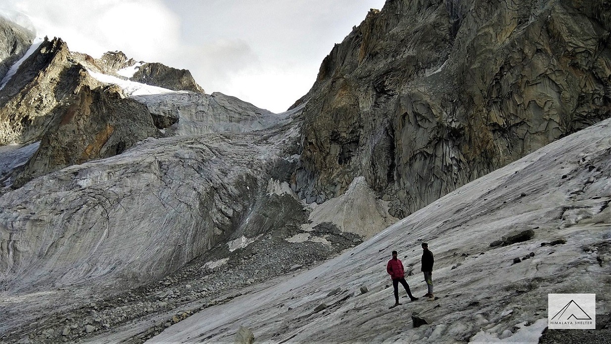
The terrain of Bamsaru Khal is highly diverse. It starts with dense forests, alpine meadows, moraine sections, snowfields and forest zones and offers a mix of challenging and beautiful landscapes. The paths also involve narrow trails, steep ascents, rocky patches and long glacier crossings.
Trekkers often require technical support as ropes, gaiters, crampons and guidance of experts. Due to it, solo trekking is not advisable. A certified guide or support team is highly recommended for safety, navigation and technical challenges.
Unpredictable weather sometimes adds more difficulty. The upper regions and the area around the pass mostly have sub-zero temperatures at night. Sudden snowfall, storms and rain are common in the region. The trek has remote routes which offer limited emergency exits. Most locations fall under isolated regions.
In short, Bamsaru Khal trek is best suited for experienced trekkers with good health, stamina and willingness. It takes you to a beautiful place but also demands seriousness in trekking and preparation.
Best time to visit the Bamsaru Khal Trek
The best time to do the Bamsaru Khal trek is from May to June and from September to mid-October. During this time, weather conditions are favourable for trekking and spending some time near the pass.
- May to June
During this time, snow on lower altitudes starts melting but you can find it on higher altitudes. However, it’s more settled by this time and chances of avalanches are less. Temperature is relatively moderate: around 10°C to 15°C in day time and can be around 0°C to 5°C at night time; trekkers must stay updated on the weather forecasts. Sudden rainfall and hailstorms can happen, especially in the afternoon. Alpine flora is in full bloom during this time.
- September to mid-October
Post monsoon, weather is more reliable as rainfall subsides by early September. Sky is clearer and visibility of mountain peaks are best. Daytime temperature is around 8°C to 14°C and at nighttime, it usually drops below 0°C, depending on lower and higher altitudes. From October, weather conditions can turn cooler so it's advisable to complete the trekking before mid October.
- Months to Avoid
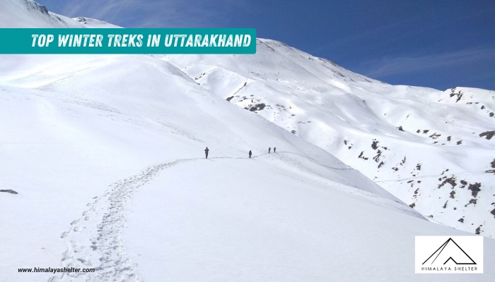
Trekkers should avoid the monsoon season (July-August) due to heavy rainfall. It increases the risk of landslides and makes visibility very poor. Trails become slippery and leech-infested. Similarly, from mid-October to April is also not considered favourable due to cold temperature and heavy snowfall blocks the trails.
How to reach the Bamsaru Khal Trek
To reach Bamsaru Khal, you first need to reach Uttarkashi. You can take a bus or taxi from Dehradun to reach here. From Dehradun, Uttarkashi is around 150 km from Dehradun and takes about 6-7 hrs by road.
Once you reach Uttarkashi, the next stop is Harsil or Dharali which are small villages located around 70 km ahead. These villages serve as a basecamp for Bamsaru Khal lake trek. You can get a shared jeep or hire a private taxi from Uttarkashi to reach Harsil/Dharali.
From Harsil or Dharali, the trek to Bamsaru Khal Lake begins. The trek is remote, adventurous and generally takes 6 to 7 days depending on your pace and chosen itinerary. The route passes through dense forests, alpine meadows, high ridges and remote valleys. You will also cross the Bamsaru Khal Pass, which is located at around 4,600 meters.
Things to carry in the Bamsaru Khal Trek
Clothing
- 3 quick-dry T-shirts (full sleeves preferred)
- 2 trek pants (water-resistant if possible)
- 1 fleece jacket or woollen sweater
- 1 down jacket or heavy padded jacket
- 1 thermal inner set (top + bottom)
- Waterproof & windproof jacket
- Poncho or raincoat
- Woolen cap + Sun cap
- Neck gaiter or scarf
- 2–3 pairs of synthetic/woolen socks + 1 pair of woolen gloves
- Innerwear (quick-dry), towel
Footwear
- Trekking shoes (ankle-high, good grip)
- Floaters/sandals (for campsites)
- Gaiters (recommended due to snow/rock)
Bags
- 50–60 litre backpack (with rain cover)
- Daypack (10–20 litre) for summit day or acclimatization walks
- Dry bags or ziplocks (to keep items dry)
Personal Gear
- Trekking pole(s)
- Sleeping bag liner (optional)
- Headlamp with extra batteries
- Water bottles (2L total capacity) or hydration pack
- UV-protection sunglasses
- Sunscreen (SPF 50+), lip balm (SPF)
Toiletries & Hygiene
- Toothbrush, toothpaste, biodegradable soap
- Wet wipes, hand sanitizer
- Toilet paper, sanitary pads/tampons (carry back used items)
- Small quick-dry towel
Personal Medical Kit
- Diamox (for altitude)
- Crocin/Dolo, Combiflam, Digene
- ORS sachets, antiseptic cream
- Band-aids, gauze, crepe bandage
- Personal meds (if any)
- Betadine/Savlon
Documents
- Valid ID proof (Aadhaar, Voter ID, etc.)
- Medical certificate (fitness)
- Disclaimer form (from your trek operator)
Others
- Power bank
- Extra camera batteries (cold drains battery fast)
- Energy bars, dry fruits, glucose
- Notebook + pen (optional for journaling)
Har Ki Dun trek Package | Bali Pass trek | Phulara Ridge Trek | Kedarkantha Trek package| Dayara Bugyal Trek Package | Gidara Bugyal trek | Gaumukh Tapovan trek | Valley of Flowers | Nag Tibba Trek | Kuari Pass trek
Bamsaru Khal Trek Route (via Himalaya Shelter):
Day 1: Dehradun to Sankri (Drive)
- Altitude: 1,920 m
- Drive: 7–8 hrs
Day 2: Sankri to Taluka (Drive), then Trek to Seema/Osla
- Altitude: 2,500 m
- Drive: 1 hr, Trek: 12 km / 5–6 hrs
Day 3: Seema to Devsu Bugyal
- Altitude: 3,000 m
- Trek: 7–8 km / 4–5 hrs
Day 4: Devsu Bugyal to Ruinsara Tal
- Altitude: 3,600 m
- Trek: 10 km / 4–5 hrs
Day 5: Ruinsara Tal to Bamsaru Khal Base Camp
- Altitude: 4,200 m
- Trek: 6–7 km / 5 hrs
Day 6: Cross Bamsaru Khal (Pass) to Kyarakoti
- Altitude: Bamsaru Khal 4,600 m
- Trek: 12–14 km / 7–8 hrs
Day 7: Kyarakoti to Harsil (Trek + Drive)
- Trek down to Harsil roadhead, then drive to Harsil town
In Himalaya Shelter, we provide you with the option to customize your Bamsaru Khal trek experience. Whether you're an avid mountaineer, an adventure seeker or a group of friends, you can opt for our personalized tailor-made expedition program.
This customized program will be exclusively designed for you, taking into account your specific requirements for transportation, accommodation, meals, technical equipment and any other premium facilities you may need during the climb.
Starting from Dehradun (pick up point), the Bamsaru Khal trek passes through dense forests, alpine meadows and various destinations including the challenging ones.
Himalaya Shelter ensures your journey is safe and memorable with experienced local guides, technical support and all necessary permits. You can even request offbeat routes or sunrise hikes for a more immersive Himalayan experience.
Moreover, no other participants will be added to your group. Choosing a customized program will enable you to enjoy your journey without any hesitation.
Day 1: Dehradun to Uttarkashi
We’ll start our journey from Dehradun Railway Station, heading towards Uttarkashi. As you travel on the right side, you’ll have a stunning view of the Ganga River below.
Along the way, we’ll make a stop at Tehri Dam. The drive to Uttarkashi offers picturesque views of valleys and mountains.
We have accommodations arranged at a hotel. In the evening, we’ll visit the city’s Kashi Vishwanath and Shakti temples
- Drive Distance – 140 km
- Drive Duration – 5 to 6 hours
Day 2: Uttarkashi to Sangam chatti and trek to Manjhi via Agora and Bhebra
Enjoy breakfast at the hotel, then drive 15 km to Sangam Chatti, about 1 hour away. Begin your trek on a steep stone trail.
As you ascend, the snow-covered mountains come into view, and Agora village can be seen in the distance. Pass by a waterfall just before the Agora welcome board, a small village.
The path narrows but remains well-trodden by villagers. Descend to Bhebra, crossing a river using rocks. Bhebra is nestled amidst mountains on three sides. Climb a ridge and stroll through the forested area, shaded by trees.
After crossing the final ridge, you’ll face Bakria Top. As you approach the huts, you’re nearing Manjhi. These are 10-15 shepherd’s huts neatly arranged. Manjhi is a forest clearing with ample space for camping. Set up your camps, have dinner, and rest for the night.
Day 3: Manjhi to Dodital
Pass through a wide expanse of oak forest. In winter, when trekking becomes challenging due to snow, an ice axe may be required. Arrive at Dodital, a tranquil lake and believed to be the birthplace of Lord Ganesha. It’s embraced by towering mountains on three sides and offers ample space.
Beside Dodital, you’ll find guest houses and temples, with a stream just before the lake. Explore the temples, and in the evening, enjoy dinner before retiring for the night.
- Trek Distance – 6.2 km
- Trek Duration – 2 to 3 hours
Day 4: Dodital to Bingad via Darawa top
Darwa Pass gives breathtaking views of snow-covered peaks like Swargarohini, Bandarpunch, and Srikantha, along with beautiful valleys and mountains. The journey starts with a climb through meadows with patches of snow. The Rhododendron trees add to the beauty.
The path gets steeper as you go, but the reward is the awe-inspiring 360-degree view from Darwa top. After a fulfilling time at the summit, start the descent. The trail isn’t clearly marked, but you may meet some shepherds along the way.
Once you reach Bingad, set up your tents and call it a night
- Trek Distance – 11.5 km
- Trek Duration – 5 to 6 hours
Day 5: Bingad to Kanatal
After breakfast, venture into the scenic Bingad valley towards Deodamini, a picturesque high-altitude meadow near Bandarpunch.
Once you’ve had your fill of Deodamini, head back to the Kanatal base. Enjoy dinner and spend the night in comfortable tents.
- Trek Distance – 11.5 km
- Trek Duration – 5 to 6 hours
Day 6: Kanatal to Bamsaru Kha and descent to Bamsaru base
Today’s challenge is ascending to Bamsaru Khal From the top, you’ll be treated to stunning views of the entire Gangotri peak group.The way down to the Bamsaru base is steep, so take your time and be cautious. Once you reach the campsite next to a stream, set up your tents and get a good night’s rest
- Trek Distance – 9.5 km
- Trek Duration – 4 to 5 hours
Day 7: Bamsaru base to Songad via Chupkatidhar
Enjoy breakfast, then climb up to the Chupkantidhar ridge. The path then leads down to Songad, a significant stream flowing from the Chhaian Bamak glacier.
Marvel at the distant Bandarpoonch and Kala Nag peaks. Set up camps by the stream for the night’s rest in tents.
Day 8: Songad to Sukki and Drive to Harsil
Starting from Nabi, ascend the outer ridge of the Bandarpunch massif, then steadily descend into the Bhagirathi valley. This path takes you to Sukhi village, where the road starts.
Next, drive from Sukhi to Harsil. This village is known for its lovely houses and internationally renowned apples. Accommodations will be arranged in a hotel there.
Day 9: Harsil to Dehradun
Depart from Harsil for Dehradun through Uttarkashi
- Drive Distance – 217 km
- Drive Duration – 8 to 9 hours
Bamsaru Khal Trek Inclusion
- All accommodations on twin sharing tents as per the itinerary.
- All meals during the trek (vegetarian with occasional serving of eggs) including breakfast, hot/packed lunch, and dinner with morning and evening tea Mayali Pass Trek
- Certified Trek Leader, Cook and Support Staff
- Medical Kit
- Forest Permits
- Camping Equipment including tents, kitchen & dining tents, toilet tents etc
- Gaiters, Microspikes, when needed
Bamsaru Khal Trek Exclusion
- Anything is is NOT mentioned in the “Inclusions” or personal expenses.
Read More on Bamsaru Khal Trek
Treks by Categories
Treks By Month

Treks By Experience


