Satopanth Lake Trek
TREK DIFFICULTY
Moderate - Difficult
TREK DURATION
6 Days
HIGHEST ALTITUDE
14,400 Feet
GROUP SIZE
12
TREK DISTANCE
31 Km
BASECAMP
Uttarakhand
BEST TIME
May to June and September to October
PICKUP POINT
Dehradun (Prince Chowk)
Satopanth Lake Trek Overview
Satopanth lake is a glacial lake in Uttarakhand, India, located in the midst of snow-capped peaks at an altitude of 4,400 meters (14,400 feet) above sea-level. The lake is considered to be of religious significance to the local people; residents of Mana village throw the ashes of the dead in the lake. Many people believe that the Trimoortis, viz, Brahma, Vishnu and Mahesh, take bathe in the lake on an auspicious day. Certain species of birds are found here, which pick up the pollutants of the lake and thus keep the lake clean. These birds are not found anywhere. The local belief is that they are the Gandharvas disguised, who guard the lake against evils.
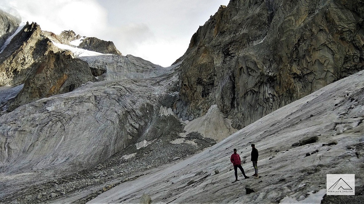
Geologically this is a glacial corrie lake. The alkapuri glacier is huge and a lot of corrie lakes are formed and this one is the biggest. The waters of the lake are held by the vast boulders and lateral moraines of the glacier. The beauty of this trek is that it starts at 3300m (the altitude of badrinath) and continues alongside the Alaknanda River until the alkapuri glacier. The junction of the 2 glaciers is a magnificent sight. The peaks of neelkanth, balakun and Satopanth give company throughout the trek. The camping locations on this trek are devoid of any trees and are beautiful alpine meadows. There are numerous waterfalls along the way which make the walk a pleasant sight.
The trek is moderate-difficult especially for the trekkers lacking high-altitude trek experience. The best time to undertake your trekking journey is from May to October except for monsoon time. The trek is ideal for those who want a spiritually fulfilling experience along with scenic adventure of mountains.
History of Satopanth Lake Trek
The name 'Satopanth' means the 'path of truth' which speaks of the significance of truth and purity. It is believed that taking a bath in Satopanth Lake washes away all sins and leads one to the path of truth and moksha (liberation). The lake is triangular in its shape which is often associated with three supreme divines (Brahma, Vishnu & Mahesh). Locals believe that all 3 divines take bath in this lake on Ekadashi.
The Satopanth Lake has been mentioned in the Mahabharata's Swargarohan Parv where Pandavas journey to Swargarohini (liberation) has been described. It is believed that when the Pandavas were ascending towards Swargarohini (heaven) and meeting their end one by one, Satopanth Lake was the place where Bhima gave up on his life. This is why the lake came to be known as Satopanth. It is also said that the Swargarohini glacier (a little farther to Satopanth) has seven steps leading to heaven. However, usually only three steps are visible, while the rest remain hidden under layers of deep snow.
The Satopanth Lake is formed by the Alkapuri Glacier. The water of the lake is held by the vast boulders and lateral moraines of the glacier. It is said that despite the extremely cold temperature, the water of the lake never freezes. People of Mana village believe that throwing the ashes of the dead into the lake helps the departed soul attain moksha (liberation from the cycle of rebirth) sooner.
Highlights of the Satopanth Lake Trek
- Vasudhara Falls: Vasudhara Falls is believed to be a celestial place connecting with the Mahabharata. Here, Sahadeva, the youngest brother of Pandavas was believed to leave his body while on the journey to Swargarohini. The water of this fall is believed to have healing properties and taking a bath under this fall is considered holy.
- Lakshmi Van: This beautiful campsite is named after Goddess Lakshmi. As per mythology, this place is blessed with the divine blessings of Goddess Lakshmi. In the context of Mahabharata connection, here Nakul, the younger brother of Pandavas abandoned his body. Laxmi Van is surrounded by Bhojpatra trees (Himalayan Birch) and offers a scenic and peaceful halt for trekkers.
- Chakratirtha: As per mythology, this place was created by Lord Vishnu’s Sudarshan Chakra. Chakratirtha is a large and open meadow and considered a spiritually powerful site where you can feel the divine calmness. It is surrounded by the majestic peaks like Neelkanth and offers a serene and spiritual atmosphere to connect with your soul.
- Sahastradhara: Sahastradhara means 'thousands springs'. This place is filled with water streams where mineral-rich water flows down in the form of small falls. Trekkers often camp here to experience the therapeutic charm and soothing sound of water. The water of this fall is considered holy and brings purity to the soul. Surrounded by caves and hills, it feels both healing and mystical.
- Mana Village: Mana Village is known as 'the last Indian village' (from India side) or 'the first village' (from Tibet side) and holds deep mythological significance. Here you can find ancient caves like Vyas Gufa and Ganesh Gufa, associated with Mahabharata. Snowcapped peaks and rivers like Alaknanda and Saraswati add a scenic charm to this place.
Difficulty Level of Satopanth Lake Trek
Satopanth Lake trek is a moderate to challenging trek suitable for those who have prior trekking experience or a good fitness level. The elevation point of the trek is around 4,600 m above sea level. Since it passes through remote regions like Lakshmi Van, Chakratirtha and Sahastradhara, trekkers need to be prepared mentally and physically for challenging stretches and camping conditions.
The trek is not ideal for families, kids and elderly people, especially those who have no prior high-altitude trekking experience. The trail demands physical and mental endurance as trekkers have to walk for 5-8 hrs in a day through uneven terrain, steep ascents, rocky and glacial sections along with river crossings and dense forest paths. Trek duration is around 6 to 7 days, depending on chosen itinerary. There are beautiful campsites where trekkers can take acclimatization halts.
Though no particular technical challenges occur while trekking, path difficulty increases due to remote areas and limited access to emergency facilities. Especially after Mana village, there's a lack of settlements like shops and guesthouses. Trekkers need to carry all essentials, including food, tents and medical supplies. Beginners can attempt this trek but they need to be physically fit and to be guided by professional trek leaders.
For navigation and safety concerns, solo trekking is not advisable. Taking help of a certified guide or joining a group is highly recommended. Since the route is close to the Indo-Tibetan border, special permits are mandatory and army check posts are present along the way.
For weather conditions, air feels thin at higher altitudes. Nights can be freezing. The best time is early summer and autumn. Outside of these windows, rain and snowfall make the trail slippery and unsafe.
Best Time to Visit the Satopanth Lake Trek
Satopanth Lake trek is best done during summer (May-June) and autumn (September-October). This time the weather is stable, trails are accessible and the sky is clear to spot the stunning views of the Himalayas.
- May-June
By this time, the snow starts melting and trails open up into lush green alpine meadows. The landscapes are fresh and blossoming with wildflowers. This is the right time for exploring more about the places. The daytime temperature is around 10°C to 20°C and can be around 5°C near the lake. At night time the temperature can drop to 0°C and around -5°C near the lake. Sudden rainfall or hailstorm can happen; keep check on weather updates.
- September-October
After the monsoon, the weather becomes dry and crisp but the sky is at its clearest which makes mountain visibility perfect. Forests start turning golden and brown which give warm and cozy vibes. Due to visibility, photography can be done at its best. The daytime temperature remains around 5°C to 15°C while at night time can drop below 0°C and to -10°C near the lake. The trails are dry and comfortable for walking.
- Months to Avoid
July-August should be avoided due to the monsoon and heavy rainfall. Trails become slippery and prone to landslides. Leeches are common and chances of bacterial infection are high. Similarly, from October to April, heavy snowfall can block the trails and the weather is too cold to acclimatize.
How to Reach the Satopanth Lake Trek
To reach Satopanth lake, the journey usually begins from Haridwar or Rishikesh, which are well connected by road and rail. From here, one can take a bus or taxi to reach Joshimath via Devprayag, Rudraprayag, Karnaprayag and Chamoli.
From Joshimath, a short drive of about 45 km takes you to Badrinath town, which is the last motorable point and a pilgrimage site. Badrinath is the base camp for the trek to Satopanth Lake.
From Badrinath, the trek to Satopanth begins. The first stretch takes you to Lakshmivan, a beautiful meadow surrounded by mountains. From here, the next stop is Chakratirth. The final stretch is a challenging trail that leads to Satopanth Lake itself.
The trek usually takes about 4-5 days, depending on the pace and weather conditions. The path goes through rocky terrain, moraines and high-altitude meadows, so it requires the help of a guide or trekking agency.
Day 1: Drive from Haridwar/Rishikesh to Joshimath (approx. 9–10 hrs)
Day 2: Drive to Badrinath (1.5 hrs) → Trek to Lakshmivan (10 km)
Day 3: Trek from Lakshmivan to Chakratirth (9 km)
Day 4: Trek from Chakratirth to Satopanth Lake (5 km) → Return to Chakratirth
Day 5: Trek back to Badrinath from Chakratirth via Lakshmivan (19 km)
Day 6: Drive back to Haridwar/Rishikesh from Badrinath
Clothing
- 2-3 quick-dry T-shirts (full sleeves preferred)
- 2 trek pants (water-resistant if possible)
- 1-2 fleece jacket or woollen sweater
- 1 down jacket or heavy padded jacket
- 1-2 thermal inner set (top + bottom)
- Waterproof & windproof jacket
- Poncho or raincoat
- Woolen cap + Sun cap
- Neck gaiter or scarf
- 2–3 pairs of synthetic/woolen socks + 1 pair of woolen gloves
- Innerwear (quick-dry), towel
Footwear
- Trekking shoes (ankle-high, good grip)
- Floaters/sandals (for campsites)
- Gaiters (recommended due to snow/rock)
Trekking Gear
- 50–60L backpack with rain cover
- 20–30L daypack (for summit day & side hikes)
- Trekking poles (highly recommended)
- Headlamp with spare batteries
- Sleeping bag (–10°C to –20°C comfort rating, if not provided)
- Dry bags or ziplocks (to keep items dry)
Toiletries & Hygiene
- Toothbrush, toothpaste, biodegradable soap
- UV-protection sunglasses
- Sunscreen (SPF 50+), lip balm (SPF)
- Wet wipes, hand sanitizer
- Toilet paper, sanitary pads/tampons (carry back used items)
- Small quick-dry towel
Personal Medical Kit
- Diamox (for altitude)
- Crocin/Dolo, Combiflam, Digene
- ORS sachets, antiseptic cream
- Band-aids, gauze, crepe bandage
- Personal meds (if any)
- Betadine/Savlon
Documents
- Valid ID proof (Aadhaar, Voter ID, etc.)
- Medical certificate (fitness)
- Disclaimer form (from your trek operator)
Others
- Power bank
- Extra camera batteries (cold drains battery fast)
- Energy bars, dry fruits, glucose
- Notebook + pen (optional for journaling)
- Some cash (no ATM in region)
In Himalaya Shelter, we provide you with the option to customize your Satopanth Lake trekking experience. Whether you're an avid mountaineer, spiritual seeker or a group of friends, you can opt for our personalized tailor-made trekking program.
This customized trek will be exclusively designed for you, taking into account your specific requirements for transportation, accommodation, meals and any other premium facilities you may need during the trek.
The trail for Satopanth Lake passes through dense forests, small villages, alpine meadows, rivers and glaciers crossing and leads to spiritual destinations like Laxmi Van, Chakratirtha and Sahastradhara.
Himalaya Shelter ensures your journey is safe and memorable with experienced local guides and all necessary permits. You can even request offbeat routes or sunrise hikes for a more immersive Himalayan experience.
Moreover, no other participants will be added to your group. Choosing a customized trek will enable you to fully enjoy the trek with your loved ones.
Day 1: Dehradun - Joshimath - Badrinath
We begin the day early and drive to Joshimath via Devprayag, Rudraprayag. One can see Devprayag (confluence of Alaknanda & Bhagirathi.) on the way. The Holy River Ganges starts from here. We reach Badrinath by evening and spend the night in a guest house.
Day 2: Badrinath - Mana - Vasudhara Falls Camp
In the morning visit Badrinath temple and later after breakfast drive a short distance to Mana village (Last village of the border). From here we will trek to Vasudhara falls via Bheem Bridge with packed lunch. Mana Village – 3 km from Badrinath, this is the last village of India on the Indo-Tibetan border. The Indo-Mongolian tribe set up this village. A population of 200 people lives here. Tourists come in plenty to this quaint village. Bheem Bridge – A short distance from Mana Village a natural bridge made of a huge boulder, over the river Saraswathi is seen. The story goes that Bheem; one of the Pandava brothers put it there. The view of this extraordinary bridge and the din of the flowing river make this place interesting. Vasudhara falls – 5 km after Bheem Bridge this astonishingly high waterfall is very attractive. The most interesting aspect about this place is that all the water here becomes vapour and vanishes into the atmosphere. The view looks like the Ganges is descending from the sky.
Day 3: Vasudhara Falls Camp - Laxmi Van - Chakrateerth Meadow
In the morning after breakfast we trek to Laxmi Van (2 kms). This is a small meadow with pastures for goat and sheep to graze. It has a few caves where gujjars stay with their flock of animals. After lunch we further trek to Chakrateerth meadow which is just 3 kms away from the lake. This is a beautiful camping ground with green grass all around and towering peaks surrounding you. At night one may also hear the glacial ice breaking away into a thunderous sound.
Day 4: Chakrateerth Camp To Satopanth Lake And Back To Laxmi Van
The trek from Chakrateerth meadow to the lake is very strenuous on the knees and is entirely over glacial debris. Walking over huge boulder and stones can take a toll on the knees but the calm and placid waters of the lake are a rewarding sight. Satopanth Lake is 18 km from Mana Village amidst the difficult areas of Himalayas. The water in the lake is very calm. On the banks of this lake are innumerable lotus flowers. We head back to our camp site and trek back to Laxmi van.
Day 5: Laxmi Van - Vasudhara Fall - Mana - Badrinath
In the morning trek back to Mana village and then drive 3 kms to Badrinath with pack lunch. One can also take the alternate route to reach Badrinath directly. Upon arrival at Badrinath check in to hotel for dinner and overnight stay.
Day 6: BADRINATH - RISHIKESH
Early in the morning drive to Haridwar via Rudraprayag & Devprayag.
Inclusion
- Transport support from and to Dehradun: starting from pickup on day 1 to drop on day 6
- Accommodation – At Base Camp, stay at a local homestay or guest house for one night each, which will give you an insight into the authentic lifestyle of the locals.( INR 5000 per person extra for single sharing throughout the trek).
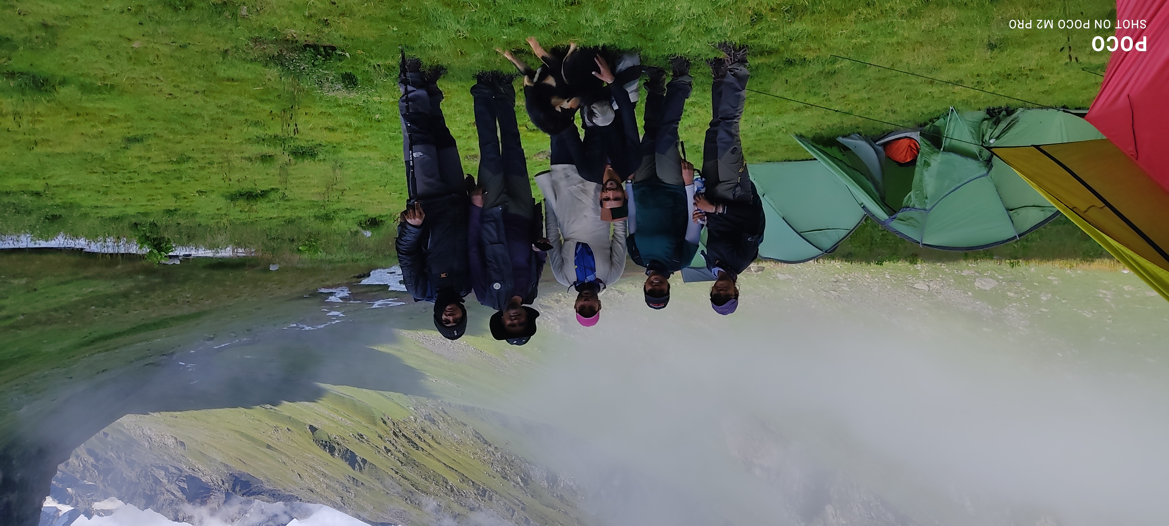
On Trek stay in a 2-person Vango Halo Pro/A-Shape tent, which is to be shared by two trekkers, built to withstand extreme weather conditions and at the same time making you comfortable after a hard day’s trek. - Camping Equipment – specially designed sleeping bags that can withstand harsh weather conditions, foam mattresses. Other safety gear like microspikes, gaiters, an ice axe, and helmets will be provided.
- Medical Kit – our team will be equipped with an extensive medical kit, which our team is trained and experienced to use. Oxygen cylinders are used after they are thoroughly inspected throughout the Trek. Even campsites have large oxygen cylinders as backups.
- Permission - Forest entry charges for Indian nationals (Additional charges will be applicable for international tourists)
- Meals – Breakfast, packed lunch (on trek days), evening snacks, and dinner will be served. A hearty, delicious, and nutrition-filled Veg meals with egg preparation will be provided throughout the trek. (Jain and Vegan Food can also be arranged on prior notification.)There will be a dedicated Kitchen Tent along with a dining tent, which will have a dining table too.
- Our Team – A highly experienced and AMC-certified Trek Leader who will help ensure that the entire trek goes smoothly and safely while navigating the challenging conditions during the trek, and is skilled enough to navigate any medical emergency that can arise during the trek. Local and route Guides who are well-versed with the region and provide an in-depth insight into the local customs and knowledge of the flora and fauna endemic to the region. A dedicated Kitchen staff, which includes a Cook, a helper, and other support staff. There will also be porters and mules to carry common equipment.
- Cloakroom - We have a cloakroom facility available for extra luggage. Every trekker is permitted to leave their luggage behind at no charge.
Exclusions
- Personal expenses like tips, personal medicines, phone calls etc.
- Travel Expenses - Travel expenses from your hometown to the mentioned Pick-Up Point are not included in the trek fee.
From the scheduled pick-up spot to the base camp, we have our own fleet of vehicles like Bolero, Innova, Dezire, or Tempo Traveler (12-seater). This is be shared by trekkers for a pre-decided amount. All vehicles are non-AC. - Personal Equipment - Any personal gear like jackets, shoes, cutlery, or backpacks are not included in the trek fee. We recommend renting them from our Rental Store for an affordable fee. This can be pre-arranged to avoid last-minute hang-ups.
- Offloading - We encourage carrying your backpack to get into the true spirit of trekking. However, if needed, you can opt to offload your personal luggage of up to 12 kgs for an additional cost of INR 500 per bag per day.
- Trek Insurance - A mandatory trek insurance fee is charged in addition to your trek fee. Since most medical insurance doesn’t cover adventure activities, trek insurance offers essential coverage, enhancing your safety without a significant financial burden.
- Buffer day on the trek - We have kept a buffer day on the trek to account for any weather-related delay. If this is utilized, you will need to pay an extra amount to your trek leader.
Anything apart from inclusions - Please carry a lunch box for a packed lunch/breakfast to avoid using polythene and Aluminium foil.
Keeping the Himalayas clean is our own responsibility. Reduce the use of Plastic when you are in the abode of the Sacred Himalaya. 🌱
Lakshmivan, Chakratirth, Sahastradhara, Satopanth Lake.
Only till Badrinath, no signal on trek route.
Neelkanth, Chaukhamba, Balakun, Parvati and Swargarohini ranges.
Mythologically linked to the Mahabharata and believed to be a meeting place of Brahma, Vishnu and Mahesh.
Read More on Satopanth Lake Trek
Photo Gallery


Treks by Categories
Treks By Month

Treks By Experience


