Buran Ghati Trek: A Complete Guide to its Landscapes, Flora, Fauna and Culture
Trek Diaries

Buran Ghati Trek: A Complete Guide to its Landscapes, Flora, Fauna and Culture

A Complete Guide to Buran Ghati Trek Landscapes, Flora, Fauna and Culture

A trek that starts from Janglikh village in the Shimla district, a very remote area. This trek is situated in Himachal Pradesh. This is not other than Buran Ghati. 

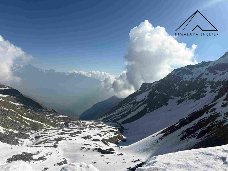
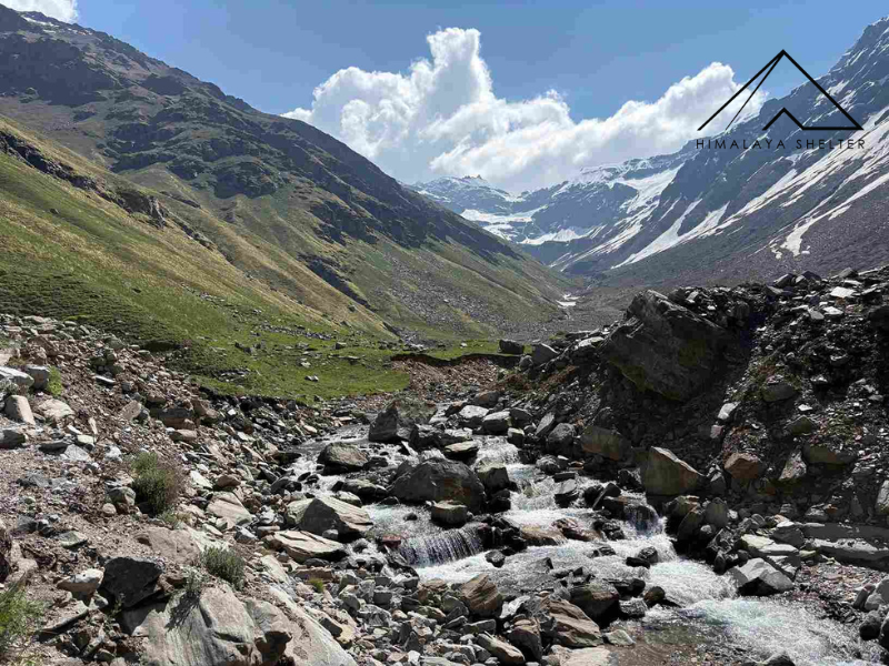
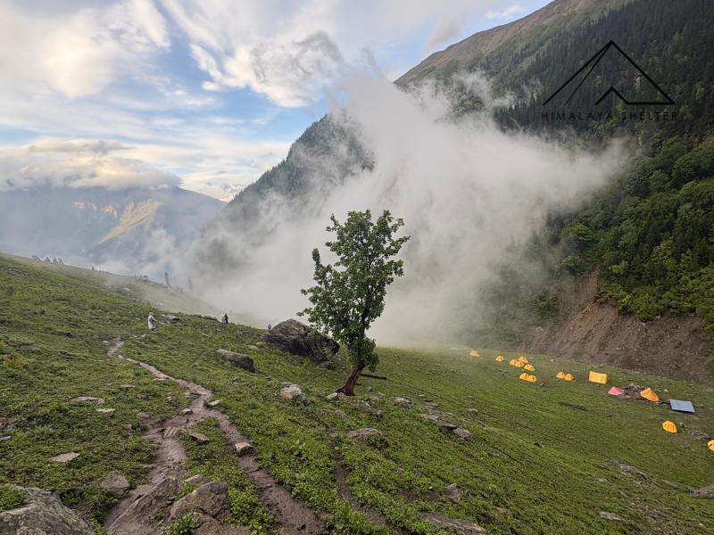
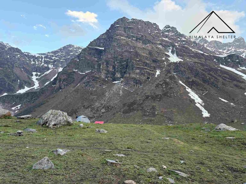
The Buran Ghati trek is a very famous crossover pass that connects the Pabbar Valley in the Shimla district to the Baspa Valley in the Kinnaur region. Directly, the pass connects one culture to another. The elevation of the pass is approximately 15,000 ft. The trail of Buran Pass is mostly used by Sheperds because the trek has alpine meadows, so locals take their cattle for grazing. Historically, it has also been used by local communities to travel between these valleys.

Let's take a dip in both valleys of Buran Pass, a complete guide to its landscapes, flora, fauna and culture.

About The Buran Pass

The Buran Pass is a high-altitude mountain pass at an elevation of 15000 ft. It lies in the Greater Himalayan range of Himachal Pradesh. The pass acts as a transition zone between two different regions.

The southern side features the lush Pabber Valley. This area has dense forests. It has flower-filled meadows. You will find glacial streams. There are broad grazing grounds.

The northern side shifts into the rugged Bashpa Valley of the Kinnaur region. The terrain becomes rockier here. The valleys are deeper. The mountains feel intense. This northern side has a lower elevation. It features more settlements based around apple orchards.

Caption

Villages of Buran Ghati Trek

On the Buran Ghati trek, you will see two different mountain villages. 

Janglik Village

Janglik is the last village of the Pabbar valley. Janglikh is an ancient village in the Shimla district of Himachal Pradesh. The village has around 200 houses, which are made in an ancient style with wooden and stone elements. It also has ancient temples and a government school. It is situated at an altitude of 9,200 ft.

Their livelihood depends on apple farming. So it is surrounded by apple orchards, apricot orchards, and tall pine trees. And at the bottom, the Pabbar River flows through the valley. The village is surrounded by tall mountains.

Barua Village 

Barua village is situated in the Kinnaur district of Uttarakhand. It is the endpoint and also the starting point of the Buran Ghati trek. It is located at an altitude of  8,235 m. It is surrounded by Deodar, pine and fruit orchards. This village has lots of fruit trees such as apple, apricot, peach and many more.

Pabbar and Baspa Valley of Buran Ghati Trek

Buran Ghati Trek gives a chance to trek in two spectacular valleys, the Pabbar Valley and the Bashpa Valley. 

Geography of Pabbar Valley

In the Pabbar Valley, the Pabbar River flows, where the Chandra River meets, which comes from the Chandranahan glacial lakes. Then, this river feeds into the Yamuna River. The Pabbar valley is very lush green with dense oak, pine and maple forests and wide meadow grounds with a wide view of the mountains, and you see many waterfalls on those mountains. The valley stretches through villages such as Rohru, Tangnu and Janglik. 

Caption

Flora of Pabbar Valley 

Pabbar Valley is very rich in flora. As altitude increases, the vegetation also changes.

Janglik to Dayara thatch

  • Kharsu Oak tree

  • Tosh tree(Himalayan Fir)

  • Walnut Tree

  • Blue Pine

  • Moss, Lichens

  • Himalayan Fern, fiddlehead fern, maidenhair fern

  • Wildflowers such as wild strawberry, marsh marigold, Himalayan cinquefoil, anemones, nagfani flower, etc.

Also Read: Himalayan Wildflowers

Dayara thatch

  • Alpine grass

  • Buttercup Flower

  • Alpine Bellflower

  • Lichens: work as a climate change indicator

  • Many colorful flowers

  • Birch Trees

  • Talihan(Vibernum)

Litham 

  • Small bushes, Rhododendron - Yellow Dwarf Flowers

  • Juniper

  • Alpine meadows 

  • Wildflowers

Bashpa Valley of Buran Ghati Trek


The Baspa Valley is also known as Sangla Valley. It sits in the Kinnaur district. The Baspa River carved this valley. The river starts from glaciers near the Indo-Tibetan border. It flows into the Sutlej River at Karcham.

Geography of the Valley

The valley stretches from Karcham to Chitkul. Towering Himalayan peaks surround it. You will see glaciers and steep slopes. It is different from the greener Pabbar Valley. Baspa Valley lies closer to the rain shadow zone. This position creates a mix of green lower slopes and rugged ground. Snowmelt keeps the river flowing. The water remains the main feature of the landscape all year.

Caption

Flora and Vegetation

Plants change as you go higher. You will find apple and apricot orchards near the villages. Pine and cedar trees grow on the lower slopes. Oak forests grow there too. Birch trees appear at higher elevations. You will find rhododendrons there as well. Alpine grasslands grow above the tree line. Wildflowers bloom in those meadows. Juniper grows in the upper reaches. Hardy shrubs survive there, too. The valley holds a lot of biodiversity.

Villages of Baspa Valley

The area has very picturesque villages. Sangla is a major settlement here. Rakchham is another village in the valley. You can visit Batseri. Chitkul is the last village on the route. These places feature traditional Kinnauri wooden architecture. People grow apples here. The local culture blends Hindu and Buddhist traditions.

Baspa Valley and Buran Ghati

Baspa Valley is the final part of the journey for people crossing Buran Pass. You spend days in the forests of Pabbar Valley first. The descent into the Baspa Valley shows a new side of the mountains. You see broader river paths and massive rock faces. Traditional settlements appear along the way. Extensive apple orchards grow around Barua and Sangla.

Buran Ghati Trek Campsite and Highlights

The Buran Ghati trek takes 7 Days to complete, including an excursion day to Chandranahan Lake trek. So it has so many highlights and campsites.

Janglik Homestay

The trek begins from Janglik. This is a traditional Himalayan village in the Pabbar Valley. Wooden houses surround the village. You will see terraced fields and apple and apricot orchards. Thick pine forests are all around. This spot offers your first glimpse into the culture of the region. It shows you the local geography.

Highlights

You will see traditional Himachali architecture. There are apple orchards. You can explore apricot orchards. The Pabbar Valley landscape is visible from here. You get to experience the local village culture.

Dayara Thatch

Dayara Thatch is a scenic campsite on the Buran Ghati Trek. You walk out of dense oak forests. The trail goes through pine woods. It passes maple trees. Then you reach vast alpine meadows. Himalayan peaks surround this area. The campsite marks the spot where the woods turn into high altitude grasslands.

Highlights

  • The area has vast rolling meadows. Green grass covers the ground. Seasonal wildflowers grow here.

  • This is a traditional grazing ground. You will often see horses. Sheep graze on the grass. Shepherds stay in the area too.

  • You get panoramic views of the surrounding ridges. Snow-covered peaks are visible from the camp.

  • The sunrises are spectacular. Sunset colours look beautiful across the grasslands.

  • This campsite is a key transition zone. It sits between the forests of the Pabbar Valley and the high alpine landscapes.

Litham Campsite

Litham serves as the geographical gateway to Buran Pass. The Litham campsite sits in a wide glacial valley. From the Litham campsite, you can see the upper glacial basin clearly from that open valley, the trail ascends towards the Buran Pass direction. On your right, the trail goes toward the Dhunda campsite, and on the left, it goes to the Chandranahan Lakes, which is also part of the trek for which you stay one day extra in Litham. Sunsets and sunrises look fantastic from Litham. It is also the junction of two rivers from the upper glacial basin Pabbar River comes from Chandranahan Glacial Lake, and the Chandra River comes and merges into the Pabbar River at Litham.

Caption

Highlights

  • The Litham is under open sky no trees, just meadows and wide mountains, streams sound.

  • From the campsite, you will get to see a beautiful waterfall on the Chandranahan side. Which is five km away but still visible.

  • It is the best place for Stargazing because the sky is so open here.

  • This campsite also have alapine meadows which remain filled with wildflower.