Day 1
On day 1, you have to drive from the state capital to Kotgaon. The duration of the drive could be between 9-10 hours.
Speaking of, Kotgaon is the base camp of the Bali Pass camp and is a meager village that houses 250 homes. Coupled with a few shops and dhabas, this makes up the commerce picture in Kotgaon. When it comes to the peak season, it’s usually hoarded with trekking activity because of its base camp status for several treks like Har Ki Dun, Kedarkantha, Borasu Pass, and Bali Pass, to say the least.
Day 2
You travel from Kotgaon to Chilurgad through Taluka, which comprises an hour drive of 12 kilometers and a trek duration of close to 7-8 hours. The trek duration is approximately 11 kilometers.
Altitude gain: 6,520 ft to 8,160 ft
Coming to the deets, there’s a road that tends to connect Jotgaon with Taluka. This brief journey might be covered through local jeeps. However, take note that the routes are closed in the Monsoon season. This trail is a level walk that goes through 10-11 hilly bends.
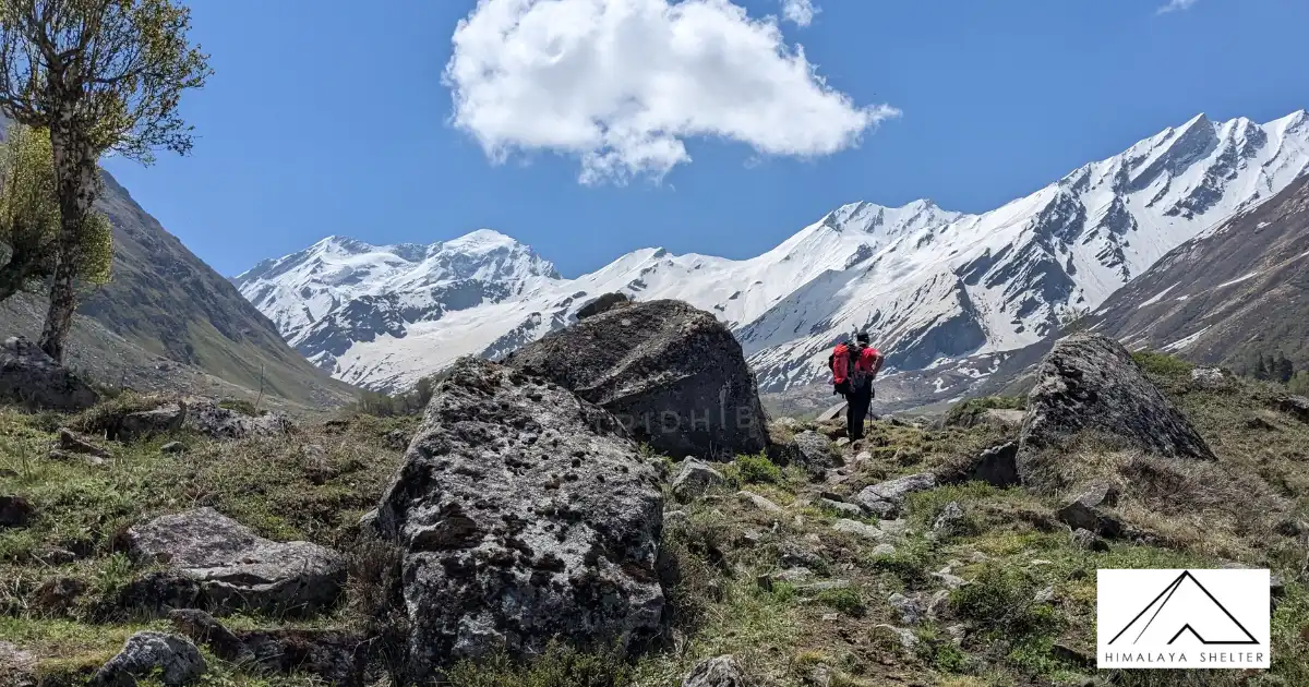
While you’re on your way, you’ll come across three significant streams gushing down the road, submerging specific road sections. Well, the hike is pretty much scenic, going past several irises, bamboo, wild roses, and deodar trees. Close to a couple of kilometers before Taluka; there’s a campsite along with the stream.
Moving on from Taluka, you’ll come across the trail descending next to the Forest Guest House into the valley of Supin. Going ahead, there are a series of trails that cross tributaries, short climbs, trails, and valley bends. The route picks up elevation once you have made your way past the forested cover with several level walks and ascents.
Day 3
On Day 3, you have to travel from Chilurgad to Devsu Thach, which involves:
Trek Duration: 4-5 hours – 6 km
Altitude gain: 8,160 ft to 9,795 feet
Begin a bit early in the morning. Take the trail that goes ahead from the campsite. Now, it’s time to pass a cemented bridge that adjoins the trail up ahead. After hiking for 20 minutes, you’ll reach Seema, where you’ll cross some dhabas and GMVN guest houses. Rush to the trail going down with sights of Supin River on the left after you cross the bridge bypass. But ensure that you do not take the ascending trail for this point. Also, take note that from this point, the hike usually ascends as you near the entry line of Ruinsara valley.
Another hour’s walk, and you will have your eyes on the Devsu Thach meadows. You must follow the trail going through the center. And, there you’ll have it, a 2-kilometer delightful walk. On the left, you can observe the Har Ki Dun valley.
Day 4
On Day 4, you have to travel from Devsu Thach to Ruinsara Tal.
Trek Duration: 4-5 hours – 10 km
Altitude gain: 9,795 ft to 11,450 ft
When you begin from Devsu Thatch, consider looking for forest trails going down sharply through the Ruinsara river. Remember, the descent is steep and rapid. Approximately 15 minutes and 120 meters of cautious descent later, a trekker will reach a bridge made of wood that goes over River Ruinsara. Here you can observe the valley towards the right.
You also need to know that the trail condition deteriorates quickly from this point as you trek toward the valley interiors. You must pass through these bends, post which you have to pass through several landslide zones. After you are an hour into the trail, you’ll come across a meadow housing birch forests forming a background.
Day 5
On day 5, you’ll embark towards Ruinsara Tal and further to Thanga.
Trek Duration: 3 hours – 3 km
Altitude: Approximately 12,000 ft
Your day 4 begins with a 10-minute walk going down the mountain toward the riverbed. Once you’re at the river, consider crossing it through a human chain. Take note that the water might be icy cold. After you have crossed the bridge, have some water while sighting the valley filled with rhododendrons to the right. Up ahead, there’s another campsite that you’ll reach around 11:30. After you have reached the destination, it’s time to relax your muscles and prepare yourself for another couple of days of climbing.
Day 6
On day 6, trek from Thanga to the advanced base camp through Odari or Bali Pass Base Camp.
Trek Duration: 5-6 hours – 5 km
Altitude gain: 13,080 ft to 15,100 ft
Well, it’s the 6th day, and this is when you’ll have some time to rest and appreciate every view you can see of the whole Kyarkoti and Ruinsara valley. From your campsite, cross the bridge and go for the landslide-prone trail on the left. Remember, the mountain ridge is entirely broken up in the boulders. Once you’re through, you’ll reach a spot from which you can spot the river crossing. It is recommended to begin early so that the water depth is not relatively high. In this case, a rope can be suitable too.
Up ahead, you can treat yourself to the pristine Swargarohini mountains for the first time in your trek duration. In the entire day 6 route, the sections are not too technical but are tedious and extended.
Day 7
On day 7, travel from the Advance Base Camp to Lower Damini through Bali Pass
Trek Duration: 9-10 hours – 14 km
Altitude loss: 15,147 ft to 10,080 ft
We’ll keep this one short. The climb to this Pass is pretty steep, and you may need an expert in the area to scout the route. There is a lot of snow and no crevasses. If you’re not prepared enough to run through this, you might lack speed. As a result, an ice ax comes in handy here.
Once you have reached the Bali Pass summit, consider enjoying an eventful view of the Yamunotri and Ruinsara ranges. You can even spot Kalanag, the black peak, and Bandarpoonch, which is referred to as the white one with a tail-like summit. Once you’re down, observe snowfields descending on the right. From here, you’ll come across several routes that can be taken. So, follow the guide for more information.
Once you have entered Damini’s upper forests, get back to the well-defined trail that only descends rapidly.
Day 8
On the last day, travel from Lower Damini to Janakichatti and finally to Dehradun.
Trek Duration: 1 hour – 6 km
Driving duration: 8 hours – 169 km
Altitude loss: 10,080 feet to 8,270 feet
This is by far the easiest one. You must take the descending trail and connect your route to the old Yamunotri trail. After a few minutes, you’ll reach the Janakichatti pilgrim trail. Since the route is cemented, one can only take a couple of hours to reach Janakchatti. From this point, board a shared jeep or bus back to Barkot or Dehradun.