
Nag Tibba Uttarakhand : Highest Peak in the Lesser Himalayan region of Uttarakhand
Nag Tibba, which means ‘Serpent’s Peak,’ is part of the Lesser Himalayas, specifically the Dhauladhar range, Pir Panjal range, and Nag Tibba range. It stands at 3,050 meters (10,006 feet) above sea level, making it the highest peak in the Lesser Himalayan region of Uttarakhand, located in the Garhwal Division. Nag Tibba gives its name to the ‘Nag Tibba Range,’ the second-northernmost of the five folds of the Himalayas. Nag Tibba is approximately 10 km from Pantwari, a small village, and roughly 60 km from Mussoorie, a renowned hill station in Uttarakhand. The 10 km distance from Pantwari to the peak can be covered through any reputable organization by searching for ‘Nag Tibba Trek‘ in Uttarakhand.
Lesser or Middle Himalayas–
There’s a place between the Shiwaliks in the South and the Greater Himalayas in the North, often called the Himachal or Lower Himalayas. These Lower Himalayan ranges are about 60-80 km wide and roughly 2400 km long. The heights here go from 3,500 to 4,500 m above sea level. Some peaks in this area go above 5,050 m and stay snowy all the time. In Uttarakhand, you’ve got the Mussoorie and Nag Tibba ranges in the Middle Himalayas. The Lesser Himalayas include the Dhauladhar range, Pir Panjal range, and Nag Tibba range.
Pir Panjal range. It’s the longest, over 300 km from the Jhelum River to the upper Beas River. The peaks can reach 5,000 meters, and it’s mostly made of volcanic rocks. There are some passes you should know about, like Pir Panjal Pass (3,480 m), Bidil (4,270 m), Golabghar Pass (3,812 m), and Banihal Pass (2,835 m). Banihal Pass is super important—it links the Kashmir Valley to Jammu through the Jammu-Srinagar highway and Jammu-Baramulla railway. And oh, the Kishanganga, Jhelum, and Chenab rivers flow through this range, making it even more interesting!
Mythology of the Nag Tibba–
Nag Devta from which it gets its name, as ‘Tibba’ is a local word for hill/peak. Local villagers used to come here to offer their prayers to Nag Devta for protection. The Nag Tibba range derives its name from the temple dedicated to Nag Devta, a significant figure in Hindu mythology. Snakes have always held a crucial status in Hindu religion as they symbolize rebirth, death, and mortality, metaphorically “reborn” with the shedding of their skin. In ancient times, religion and worship were responses to a way of life rather than a reason for existence; moreover, snakes were accorded a cult status. In certain regions, snake gods are associated with fertility.
Hindu mythology features numerous snake god myths and iconographic symbols linked to them, such as Sheshnag (Vishnu’s resting couch), Anantnag (the endless snake), Kaliya (Krishna’s dance), Vasuki (churning of the ocean), Padmanabha (guardian snake), and Manasa Devi (snake goddess). For the villagers in the Nag Tibba valley, Nag Devta is the protector of their cattle and sheep, their most valuable assets.
How to reach to the Nag Tibba–
Nag Tibba Summit is accessible by trekking and by the drive to the Pantwadi village. Dehradun is accessible from all the states of India. Nag Tibba is a 10 km trek from the base camps in Pantwari, and Pantwari is located at a distance of 60 km from Mussoorie and 90 km from Dehradun.
Nearest Railway Station: Dehradun is the nearest railway head. Mussoorie is located at a distance of 33 km from the railway head.
Nearest Airport: Dehradun’s Jolly Grant is the nearest airport. Mussoorie is located at a distance of 60 km from the Jolly Grant Airport.
Sunset View From The Campsite–
Nag Tibba is known as one of the best Himalayan treks because of the amazing experience at its campsites. Camping in Uttarakhand is exceptionally delightful here. The trail sets up stunning sunsets, making them even more special. The snowy peaks – Bandarpoonch, Swargarohini, and Gangotri – look like they’re glowing in a warm, orange light as the sun sets, making the campsite feel peaceful and magical.
Mountain view from Summit–
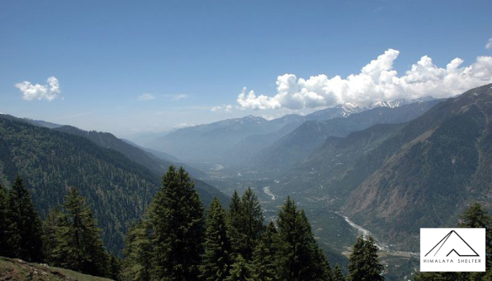
Nag Tibba is located at the foothills of Tehri, giving you a breathtaking view of the majestic Himalayan range during sunrise.
From this spot, you can see the shining, snow-covered peaks of Garhwal and Kumaon. Nag Tibba is a great choice for those who want a short but impressive introduction to the stunning Himalayan Peaks. It’s perfect for anyone looking for a captivating adventure without a long trek—a great way to start exploring.
Nanda Devi & Trishul:
From the Nag Tibba summit, you get an amazing view of the mountain ranges stretching from Swaragrohini to Nandadevi. Mount Nandadevi, standing tall at 25,643 feet, is one of the most beautiful peaks in the Indian Himalayas.
The Gangotri Range:
Closer views from Nag Tibba reveal peaks around 20,500 feet high. Mountains like Gangotri, Jaonli, and Draupadi ka Danda are popular among mountaineers, especially students of Mountaineering, for honing their skills.
Kalanag and Bandarpoonch:
Among the most captivating sights visible from the Nag Tibba trek are the Bandarpoonch range and Mt. Kalanag. The twin peaks of Bandarpunch-I (20,721 feet) & Bandarpunch-II (White peak – 20,019 feet) create the impression of a monkey’s tail. Climbed for the first time in 1950 by a team that included the legendary Mountaineer & Sherpa Tenzing Norgay, Mt. Kalanag or Black Peak (20,955 feet) features a near-vertical rock face resembling a black cobra.
Swaragrohini Range:
To the left of Bandarpoonch are the famous four pinnacles of the Swaragrohini massifs (3, 2, 1, 4). From Nag Tibba summit, you can see Peak no. 3, 2 & 1. According to local folklore, the Pandavas, Draupadi, and their dog ascended to heaven through these peaks.
Mt. Srikantha:
The asymmetrical pyramid peak visible between White Peak and the Gangotri range is Mt. Srikanta (20,121 feet). Limited information is available about this peak, moreover, it poses technical challenges for mountaineers due to its remoteness, tricky camping spots, steep ice wall, and narrow summit ridge covered by a cornice.
About Author

Himalaya Shelter
Recent news
16 Feb 2026
11 Feb 2026
11 Feb 2026
10 Feb 2026
05 Feb 2026
Recommended Treks

Cost: ₹4000 | $34
Type: Easy
Best Time: January, February, March, April, May June, July, August, September, October, November, December