Early morning after breakfast drive to joshimath which is 294 km and around 10 hours ride from Dehradun. Dinner and Overnight stay in a hotel.
The trek starts from an unassuming village called Jumma, which is an hour’s ride from Joshimath. Pick up trek ration and kerosene at Joshimath or on the way at Suraithota, as there are almost no supplies available after you begin the trek. The ride from Joshimath to Jumma is a little bumpy. You’ll drive across villages like Tapovan, Reni, Lata, Suraithota and Phagti. In between Suraithota and Jumma, the road winds beside River Dhauliganga. This makes for a lovely drive, especially in autumn. But it can be equally menacing during monsoon.Dinner and overnight stay in tents.
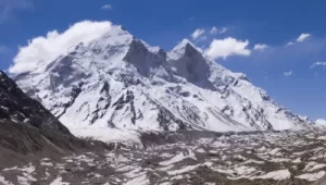
Today’s trek is quite easy. After leaving Dronagiri, trace a path that meanders to a high ridge, from where you can catch your first views of Rishi peak and Bagini Nala. Around 30 minutes after leaving the village, you’ll come across a concrete bridge over Bagini Nala. There is another trail going left from the bridge. Do not take that trail as it goes to Kanari Khal and gradually towards Garpak village. Cross the bridge and continue on the ascending trail. This area is almost completely void of vegetation. It’s packed with boulders. Around 90 minutes after crossing the bridge, you’ll come across a green patch beside a stream. This could serve as an emergency camping ground. Longatulli lies an hour away and you can camp there for the night. Dinner and overnight stay in tents.
Proceed on the route to Bagini Glacier for 1 km, till you reach the tri-junction bridge over Bagini River. From here, the trail to Kanari Khal goes towards the left side of a steep ridge. The shepherd trail here is narrow and very steep. The trail is above the treeline and has an expansion of tall grasses all over. In the distance, you can see the saddle of Kanari Khal. Observe Bagini River gushing below you in a narrow gorge. Dinner and Overnight stay in tents.
After yesterday’s grueling trek, today’s trek is a scenic one. You’ll be trekking along Lampak and Bagini streams all the way to Jumma. One kilometer down the trail from Garpak towards Ruing, you’ll come across a bridge over Lampak stream. Walk alongside Lampak stream till it merges with Bagini stream. Here, cross the bridge and connect to the village trail that comes from Ruing. From here retrace the trail you took on day one, all the way to Jumma. From Jumma, you can take a jeep to Joshimath. Dinner and overnight stay in tents/guest house.
Early morning after breakfast head towards dehradun via joshimath.End of your trek with happy memories.